 Visualizza questa pagina in Italiano
 HOME PAGE
|
Visualizza questa pagina in Italiano
|
HOME PAGE
|
Legend and translations |
| GER - GERMANY | |||||||||||||||||
| DUDENHOFEN (OPEL) | |||||||||||||||||
| Description | Opel private proving ground used for series cars | ||||||||||||||||
| Location | Dudenhofen RP - Rheinland-Pfalz - 1949÷1990: BRD | ||||||||||||||||
| Location | 50 km - 31 mi East from Opel factory in Rüsselheim | ||||||||||||||||
| Latitude - Longitude | + 49°59'34" + 8°55'23" 49.992778 8.923056 | ||||||||||||||||
| UTM Coordinates | X = 494484.823 - Y = 5537830.565 - Zone 32U | ||||||||||||||||
| Aerial photo / Map (*) |  Google Maps - Bing Maps - Flash Earth - GoYellow.de Google Maps - Bing Maps - Flash Earth - GoYellow.de | ||||||||||||||||
| Altitude AMSL | 150 m - 492 ft | ||||||||||||||||
| Inauguration | 1966 | ||||||||||||||||
| Closing | |||||||||||||||||
| Designer | |||||||||||||||||
| Sources and links (Translation) (**) |
| ||||||||||||||||
| External circle ring | |||||
| Opel Proving Ground | |||||
| Description | Banking compensated up to 225 km/h - 140 mph | ||||
| Years | |||||
| Direction | |||||
 Proposal Proposal |
NO | ||||
| No longer operational | |||||
| Car Circuit | YES | ||||
| Motorbike circuit | |||||
| Type | Proving ground | ||||
| Inauguration | |||||
| Closing | |||||
| Last update of this page | January 12th 2007 | ||||
| Info last update | |||||
| Designer | |||||
| Distinctive points | |||||
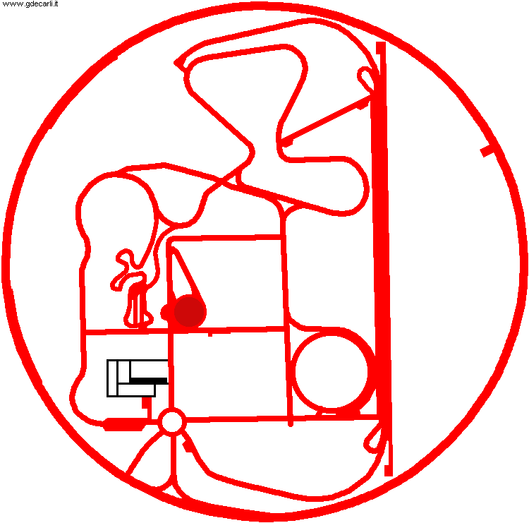
| length | 5000 m | 16404 ft | 3.107 mi | (4) | |
| Bend minimum radius | 1609 m | 5280 ft | 1 mi | (4) | |
| Total area | 260 hectares | 2600000 m² | 642.467 acres | (4) | |
| Dudenhofen (Opel) | |||||
| Opel Proving Ground | |||||
| Description | Steering pad diameter: 100 m - 328 ft | ||||
| Years | |||||
| Direction | |||||
| Proposal |
NO | ||||
| No longer operational | |||||
| Car Circuit | YES | ||||
| Motorbike circuit | |||||
| Type | Proving ground | ||||
| Inauguration | |||||
| Closing | |||||
| Last update of this page | January 12th 2007 | ||||
| Info last update | |||||
| Designer | |||||
| Distinctive points | |||||
| Straight length | 1400 m | 4593 ft | 0.87 mi | (4) | |
Dudenhofen (Opel)
| Updates | |||||||
| Date | Track layout | Years | Description by | Map by | Thanks to | Note | |
| July 5th 2012 | Guido de Carli | Update | Description | ||||
| January 12th 2007 | Guido de Carli | Update | Description | ||||
| March 16th 2005 | Guido de Carli | Update | Map | ||||
| December 29th 2003 | Guido de Carli | Update | Description | ||||
| Not all eventual updates issued in last years are already visible in this list | |||||||
Webmaster:
Guido de Carli

(Italiano - English - Español)
HOME PAGE