 Visualizza questa pagina in Italiano
 HOME PAGE
|
Visualizza questa pagina in Italiano
|
HOME PAGE
|
Legend and translations |
| ITA - ITALY | |||||||||
| LACENO | |||||||||
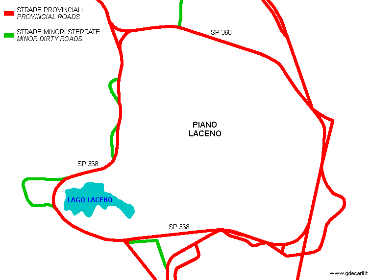
| Description | Proposal for transforming the recent (in 1971....) road around Piano Laceno in a 90% semipermanent circuit suitable also for F.1. For safety reason, track layout is a little changed from original street Provincial Road SP 368. Piano Laceno is at 1050 m above sea level and in Winter is often covered in snow. In 1972 works for building the road were going on, but AC Avellino (Automobil Club Avellino) and CSAI objected to its transformation into a semipermanent circuit: it would have been too fast and too far away. I don’t think this circuit was ever finished, but on aerial photos available on Portale Cartografico Nazionale you can see some minor roads that seems to be abandoned track section under construction (green on second map). | ||||||||
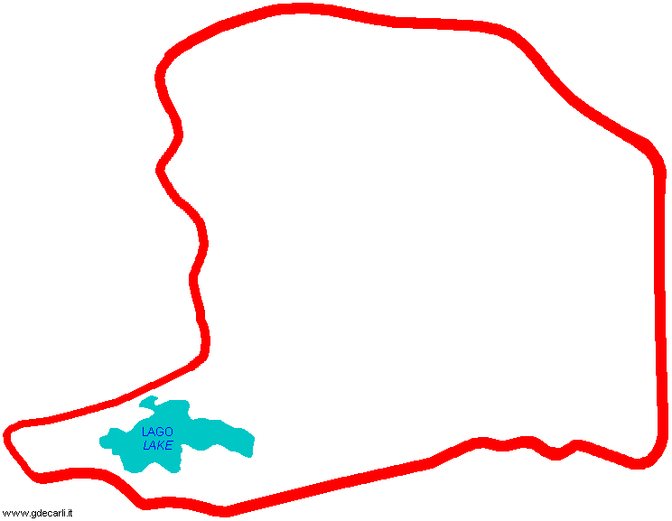
| Location | Bagnoli Irpino AV - Avellino - Campania | ||||||||
| Location | Around Piano Laceno and Lake Laceno, Bagnoli Irpino | ||||||||
| Latitude - Longitude | + 40°48'39" + 15°06'23" 40.810833 15.106389 | ||||||||
| UTM Coordinates | X = 508973.011 - Y = 4517763.521 - Zone 33T | ||||||||
| Aerial photo / Map (*) |  Google Maps - Bing Maps - Flash Earth - Portale Cartografico Nazionale - Visual Pagine Gialle Google Maps - Bing Maps - Flash Earth - Portale Cartografico Nazionale - Visual Pagine Gialle | ||||||||
| Altitude AMSL | 1050 m - 3445 ft | ||||||||
| Inauguration | |||||||||
| Closing | |||||||||
| Designer | |||||||||
| Sources and links (Translation) (**) |
| ||||||||
| Autodromo del Laceno | |||||
| Description | |||||
| Years | 1971 | ||||
| Direction | |||||
 Proposal Proposal |
YES
| ||||
| Proposal not developed | YES | ||||
| Car Circuit | YES | ||||
| Motorbike circuit | |||||
| Type | Road course | ||||
| Inauguration | |||||
| Closing | |||||
| Last update of this page | May 18th 2005 | ||||
| Info last update | February 1972 | ||||
| Designer | |||||
| Distinctive points | |||||
| length | 6500 m | 21325 ft | 4.039 mi | (1) | |
Autodromo del Laceno - Track map
| Updates | |||||||
| Date | Track layout | Years | Description by | Map by | Thanks to | Note | |
| August 18th 2005 | Guido de Carli | Update | Description | ||||
| June 11th 2005 | Guido de Carli | Update | Description | ||||
| February 9th 2004 | Guido de Carli | Guido de Carli | New | Description with map | |||
| Not all eventual updates issued in last years are already visible in this list | |||||||
Webmaster:
Guido de Carli

(Italiano - English - Español)
HOME PAGE