|
BAH - BAHAMAS |
| FREEPORT |
| SORRY, SOME DATA ARE NOT TRANSLATED YET |
| Description |
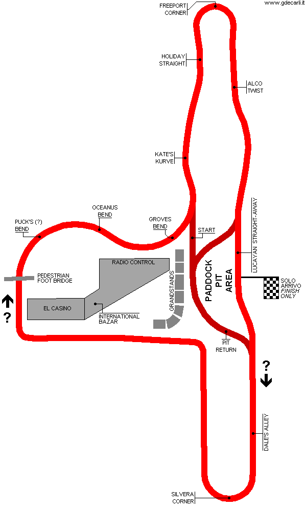
Circuit used - probably for the first time - for traditional Speedweek Bahamas at the end of 1967. Direction clockwise is to be confirmed |
| Location |
Freeport - City of Freeport (Grand Bahama) |
| Location |
Around Freeport Casino |
| Latitude - Longitude (approx) |
+ 26°32'00" - 78°39'00" (approx)
26.533333 -78.65 (approx) |
| UTM Coordinates (approx) |
X = 734150.136 - Y = 2936895.157 - Zone 17R (approx) |
| Aerial photo / Map (*) |
 OpenStreetMap - Google Maps - Bing Maps - Flash Earth - Wikimapia OpenStreetMap - Google Maps - Bing Maps - Flash Earth - Wikimapia |
| Altitude AMSL (approx) |
7 m - 23 ft (approx) |
| Inauguration |
|
| Closing |
|
| Designer |
|
| Sources and links (Translation) (**) |
| (1) |
 |
Autosprint 2/1968 (page 21) | Mappa |
|
 Clockwise
 Proposal