| GBR - UNITED KINGDOM | |||||||||||||
| NORTH WEALD | |||||||||||||
| Description | |||||||||||||
| Location | North Weald ESS - Essex - England | ||||||||||||
| Location | |||||||||||||
| Latitude - Longitude | + 51°43'07" + 0°09'23" 51.718611 0.156389 | ||||||||||||
| UTM Coordinates | X = 303581.631 - Y = 5733569.58 - Zone 31U | ||||||||||||
| Aerial photo / Map (*) |  OpenStreetMap - Google Maps - Bing Maps - Flash Earth - Wikimapia OpenStreetMap - Google Maps - Bing Maps - Flash Earth - Wikimapia | ||||||||||||
| Altitude AMSL | 81 m - 266 ft | ||||||||||||
| Inauguration | |||||||||||||
| Closing | |||||||||||||
| Designer | |||||||||||||
| Sources and links (Translation) (**) |
| ||||||||||||
| North Weald | |||||
to be verified | |||||
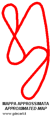
| Description | North Weard airfield hosts many dragster races, of course using a strip as drag strip. But some different events has been organized here that used a circuit: i.e. moleracing.com shows a Formula Vauxhall Lotus on the starting line in March 2004. According to the same site, it is a bumpy airfield that uses an interesting mixture of flat out straights, twisty chicanes and a roundabout followed by a sweeping fast complex of curves to complete the mile long course. The only map I found is on Creative Vinyls shops, but it’s in perspective and low quality. Besides, I tried to fit this map to airfield aerial photo available on Multimap, but with no results. So there is something wrong: I don’t know if the map is wrong, if the circuit was built after aerial photo was taken or if there is any more problem. | ||||
| Years | |||||
| Direction | |||||
 Proposal Proposal |
NO | ||||
| No longer operational | |||||
| Car Circuit | YES | ||||
| Motorbike circuit | |||||
| Type | Airfield course | ||||
| Inauguration | |||||
| Closing | |||||
| Last update of this page | June 11th 2006 | ||||
| Info last update | |||||
| Designer | |||||
| Distinctive points | |||||
| length (approx) | 1609 m | 5280 ft | 1 mi | to be verified | |
| North Weald | |||||
| Description | |||||
| Years | 2007 | ||||
| Direction | |||||
| Proposal |
NO | ||||
| No longer operational | YES | ||||
| Car Circuit | YES | ||||
| Motorbike circuit | |||||
| Type | Point to point track | ||||
| Inauguration | |||||
| Closing | 2007 | ||||
| Last update of this page | February 13th 2009 | ||||
| Info last update | |||||
| Designer | |||||
| Distinctive points | |||||
| length (approx) | 1700 m | 5577 ft | 1.056 mi | (3) | |
| North Weald | |||||
| Description | |||||
| Years | 2008 | ||||
| Direction | |||||
| Proposal |
NO | ||||
| No longer operational | |||||
| Car Circuit | YES | ||||
| Motorbike circuit | |||||
| Type | Point to point track | ||||
| Inauguration | 2008 | ||||
| Closing | |||||
| Last update of this page | February 13th 2009 | ||||
| Info last update | |||||
| Designer | |||||
| Distinctive points | |||||
| length | 2260 m | 7415 ft | 1.404 mi | (3) | |
North Weald, before 2004
| Updates | |||||||
| Date | Track layout | Years | Description by | Map by | Thanks to | Note | |
| February 13th 2009 | Guido de Carli | Update | Description | ||||
| December 7th 2004 | Guido de Carli | New | Description with map | ||||
| Not all eventual updates issued in last years are already visible in this list | |||||||


