| FRA - FRANCE | |||||||||||||||||||||||||||||||||
| BOIS DE BOULOGNE | |||||||||||||||||||||||||||||||||
| Description | In 1945 Bois De Boulogne hosted first car racing in Europe after the end of World War Two | ||||||||||||||||||||||||||||||||
| Location | Bois de Boulogne, Paris 75 - Paris - Île-de-France | ||||||||||||||||||||||||||||||||
| Location | Approx 1.5 km - 1 mi East of Circuit de Longchamps e del Circuit de Bagatelle | ||||||||||||||||||||||||||||||||
| Latitude - Longitude | + 48°51'48" + 2°15'34" 48.863333 2.259444 | ||||||||||||||||||||||||||||||||
| UTM Coordinates | X = 445686.022 - Y = 5412527.707 - Zone 31U | ||||||||||||||||||||||||||||||||
| Aerial photo / Map (*) |  OpenStreetMap - OpenStreetMap -  Google Maps - Google Maps -  Bing Maps - Bing Maps -  Flash Earth - Flash Earth -  Wikimapia - Wikimapia -  GéoPortail GéoPortail | ||||||||||||||||||||||||||||||||
| Altitude AMSL | 48 m - 157 ft | ||||||||||||||||||||||||||||||||
| Inauguration | September 9th 1945 | ||||||||||||||||||||||||||||||||
| Closing | October 6th 1946 | ||||||||||||||||||||||||||||||||
| Designer | |||||||||||||||||||||||||||||||||
| Sources and links (Translation) (**) |
| ||||||||||||||||||||||||||||||||
| Bois de Boulogne | |||||
| Description | |||||
| Years | 1945 | ||||
| Direction |  Clockwise Clockwise | ||||
 Proposal Proposal |
NO | ||||
| No longer operational | YES | ||||
| Car Circuit | YES | ||||
| Motorbike circuit | |||||
| Type | Street course | ||||
| Inauguration | September 9th 1945 | ||||
| Closing | September 9th 1945 | ||||
| Last update of this page | April 10th 2008 | ||||
| Info last update | |||||
| Designer | |||||
| Distinctive points | Route de Suresnes - Allee des Fortifications (Boulevard Périphérique) - Avenue de Saint-Cloud - Chemin Ceinture du Lac Inférieur | ||||
| length | 2826 m | 9272 ft | 1.756 mi | (4) | |
| length | 2675 m | 8775 ft | 1.662 mi | Calculated from aerial photo (*) | (3) |
| Bois de Boulogne | |||||
| Description | I know that 1946 tracks had start/finish line in Porte Maillot and they went throigh Porte Dauphine, but according to track length it seems they were two different circuits. I have no more info | ||||
| Years | 1946 | ||||
| Direction | |||||
 Proposal Proposal |
NO | ||||
| No longer operational | YES | ||||
| Car Circuit | |||||
| Motorbike circuit | |||||
| Type | Street course | ||||
| Inauguration | May 30th 1946 | ||||
| Closing | May 30th 1946 | ||||
| Last update of this page | April 10th 2008 | ||||
| Info last update | |||||
| Designer | |||||
| Distinctive points | Porte Maillot - Porte Dauphine | ||||
| length | 3191 m | 10469 ft | 1.983 mi | (8) | |
| length | 3202 m | 10505 ft | 1.99 mi | (5) | |
| Bois de Boulogne | |||||
| Description | I know that 1946 tracks had start/finish line in Porte Maillot and they went throigh Porte Dauphine, but according to track length it seems they were two different circuits. I have no more info | ||||
| Years | 1946 | ||||
| Direction | |||||
 Proposal Proposal |
NO | ||||
| No longer operational | YES | ||||
| Car Circuit | |||||
| Motorbike circuit | |||||
| Type | Street course | ||||
| Inauguration | October 6th 1946 | ||||
| Closing | October 6th 1946 | ||||
| Last update of this page | April 10th 2008 | ||||
| Info last update | |||||
| Designer | |||||
| Distinctive points | Porte Maillot - Porte Dauphine | ||||
| length | 2943 m | 9656 ft | 1.829 mi | (6) | |
Bois de Boulogne 1945
Due to technical problems, temporarily it’s no longer possible to see the circuits on Google Maps embedded in the current page.
This feature will be restored as soon as I figure out how to do (any help would be appreciated!)
See this track layout with Google Earth
- milermeter.com
(milermeter.com can be used in your browser, without installing anything; Google Earth is a program that must be installed in your computer)
(Map shown here above can show at the same time all eventual layouts drawn. If you want to see only some of them, please go to Google Maps or Google Earth, by clicking on its own link)
| PHOTOS |
| Copy of an article by Clyde Berryman about 1945 event, here published with kind permission |
| Photos by Clyde Berryman - |
| Click on thumbnail to open original large photo |
| 1 | 2 | 3 | 4 |
 |  |  |  |
| Page 1/7 | Page 2/7 | Page 3/7 | Page 4/7 |
| 5 | 6 | 7 | |
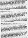 | 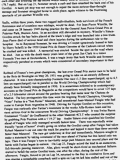 | 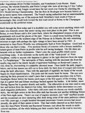 | |
| Page 5/7 | Page 6/7 | Page 7/7 |
| PHOTOS |
| 1945 layout. Photos and description in English are by Clyde Berryman, here published with his authorization. Translation in Italian is by Guido de Carli. Poisition of each photo is shown on Google Maps/Google Earth map (see above) |
| Photos by Clyde Berryman - 2002 |
| Click on thumbnail to open original large photo |
| Updates | |||||||
| Date | Track layout | Years | Description by | Map by | Thanks to | Note | |
| January 11th 2010 | 1945 | Clyde P. Berryman | Clyde P. Berryman | Update | Description | ||
| January 6th 2010 | 1945 | Guido de Carli | Clyde P. Berryman | Update | Photos (on this site) | ||
| April 10th 2008 | Guido de Carli | Guido de Carli | Update | Description with map | |||
| September 2nd 2005 | Guido de Carli | Update | Description | ||||
| June 6th 2003 | 1945 | Guido de Carli | Update | Description | |||
| May 26th 2003 | Guido de Carli | Guido de Carli | New | Description with map | |||
| Not all eventual updates issued in last years are already visible in this list | |||||||
