| BAH - BAHAMAS | |||||||||||||||||||||||||
| OAKES FIELD | |||||||||||||||||||||||||
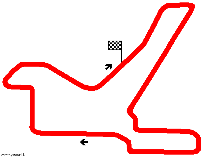
| Description | First used in 1957, it was used for Speedweek until 1966. According to "Da Monza a Indianapolis" book in 1973 this circuit was still in use. Maps on Racingcircuits.net and GEL Motorsport Tracks Around The World are slighly different on last corner, but I don’t know if this is due to a track change or a wrong map | ||||||||||||||||||||||||
| Location | Nassau - New Providence | ||||||||||||||||||||||||
| Location | |||||||||||||||||||||||||
| Latitude - Longitude | + 25°03'20" - 77°21'36" 25.055556 -77.36 | ||||||||||||||||||||||||
| UTM Coordinates | X = 261916.805 - Y = 2773176.723 - Zone 18R | ||||||||||||||||||||||||
| Aerial photo / Map (*) |  OpenStreetMap - Google Maps - Bing Maps - Flash Earth - Wikimapia OpenStreetMap - Google Maps - Bing Maps - Flash Earth - Wikimapia | ||||||||||||||||||||||||
| Altitude AMSL | 4 m - 13 ft | ||||||||||||||||||||||||
| Inauguration | 1957 | ||||||||||||||||||||||||
| Closing | |||||||||||||||||||||||||
| Designer | |||||||||||||||||||||||||
| Sources and links (Translation) (**) |
| ||||||||||||||||||||||||
| Oakes Field | |||||
| Description | |||||
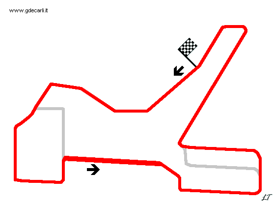
| Years | 1957 | ||||
| Direction |  Anticlockwise Anticlockwise | ||||
 Proposal Proposal |
NO | ||||
| No longer operational | YES | ||||
| Car Circuit | YES | ||||
| Motorbike circuit | |||||
| Type | Street course | ||||
| Inauguration | 1957 | ||||
| Closing | 1957 | ||||
| Last update of this page | June 20th 2007 | ||||
| Info last update | |||||
| Designer | |||||
| Distinctive points | |||||
| length | 8047 m | 26399 ft | 5 mi | (6) | |
| Oakes Field | |||||
| Description | |||||
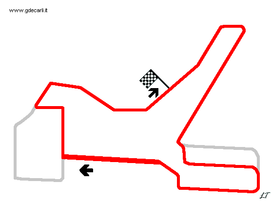
| Years | 1958÷1965 | ||||
| Direction |  Clockwise Clockwise | ||||
| Proposal |
NO | ||||
| No longer operational | |||||
| Car Circuit | YES | ||||
| Motorbike circuit | |||||
| Type | |||||
| Inauguration | 1958 | ||||
| Closing | |||||
| Last update of this page | March 20th 2004 | ||||
| Info last update | |||||
| Designer | |||||
| Distinctive points | |||||
| length | 7240 m | 23753 ft | 4.499 mi | (1) | |
| length | 7242 m | 23760 ft | 4.5 mi | (4) | |
| Width | 15.2 m | 50 ft | (1) | ||
Oakes Field 1957
Oakes Field 1958÷1965
| Updates | |||||||
| Date | Track layout | Years | Description by | Map by | Thanks to | Note | |
| January 6th 2011 | Guido de Carli | Update | Description | ||||
| June 20th 2007 | Lorenzo Tommasi | Update | Description | ||||
| June 5th 2007 | Lorenzo Tommasi | Update | Map | ||||
| January 28th 2007 | 1957 | Guido de Carli | |||||
| March 20th 2004 | 1958÷1965 | Guido de Carli | Guido de Carli | New | Description with map | ||
| Not all eventual updates issued in last years are already visible in this list | |||||||


