| CHN - CHINA, PEOPLE’S REPUBLIC OF | |||||
| KATE NAIHAI | |||||
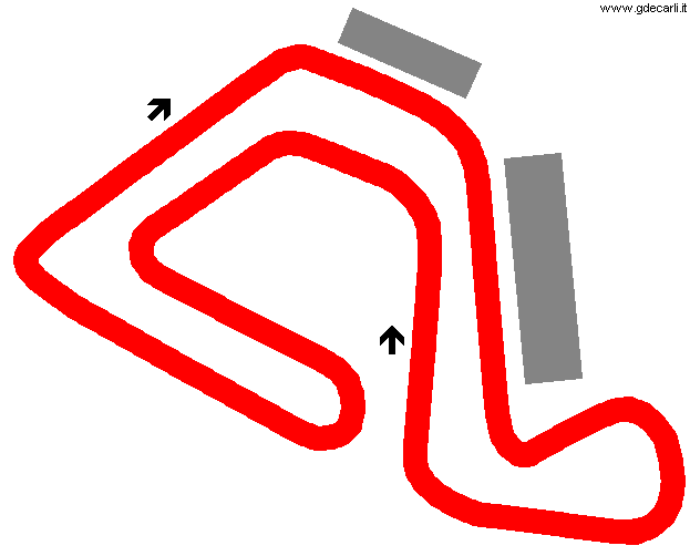
| Description | On www.qcql.com website there are some pics that show some scooters and it seems quite small. I have no more info. | ||||
| Location | |||||
| Location | |||||
| Latitude - Longitude | 0 0 | ||||
| UTM Coordinates | |||||
| Aerial photo / Map (*) | |||||
| Altitude AMSL | |||||
| Inauguration | |||||
| Closing | |||||
| Designer | |||||
| Sources and links (Translation) (**) |
| ||||
| Kate NaiHai | |||||
| Description | |||||
| Years | |||||
| Direction |  Clockwise Clockwise | ||||
 Proposal Proposal |
NO | ||||
| No longer operational | |||||
| Car Circuit | |||||
| Motorbike circuit | YES | ||||
| Type | Permanent | ||||
| Inauguration | |||||
| Closing | |||||
| Last update of this page | May 5th 2003 | ||||
| Info last update | |||||
| Designer | |||||
| Distinctive points | |||||
Kate NaiHai
| Updates | |||||||
| Date | Track layout | Years | Description by | Map by | Thanks to | Note | |
| October 28th 2005 | Guido de Carli | Guido de Carli | New | Description with map | |||
| September 17th 2003 | Guido de Carli | New | Description | ||||
| May 5th 2003 | Guido de Carli | New | Description | ||||
| Not all eventual updates issued in last years are already visible in this list | |||||||


