| CRC - COSTA RICA | |||||||||||||
| LA GUÁCIMA | |||||||||||||
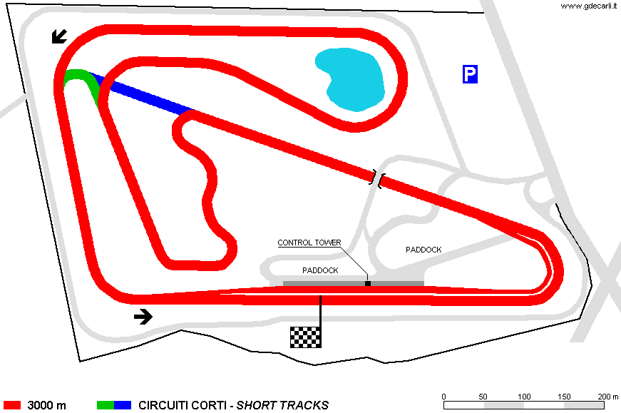
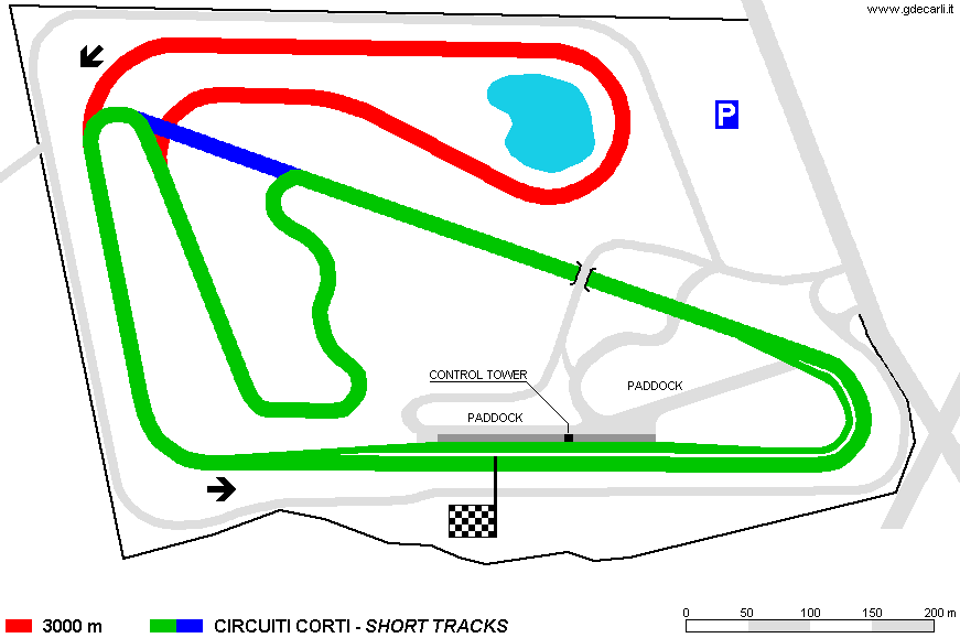
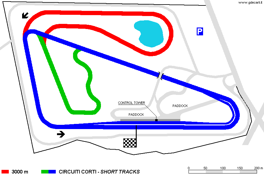
| Description | Circuit opened in 1974, since 1975 it have hosted regularly 3 Hours of Costa Rica, a touring car race. On December 11th 1988 a Group C and IMSA race was scheduled. It was named after Oscar Arias, Costa Rica president and Nobel Peace Prize winner. Pro Motor S.p.A., organizer of the event, had already spend 1.2 million of Dollars, but the race was canceled in summer 1988 for economical reason. Short circuit in blue on my map is clearly visible on 1988 map, but not on aerial photo that can be seen on official website (CONTACTENOS page); in the same photo it seems pit lane is shorter than in my map, it seems to finish on main straight and not after first corner. | ||||||||||||
| Location | San José - Alajuela | ||||||||||||
| Location | Approx 20 km - 12 mi West of San José and 6 km - 4 mi South West of Alajuela | ||||||||||||
| Latitude - Longitude | + 9°58'24" - 84°14'55" 9.973333 -84.248611 | ||||||||||||
| UTM Coordinates | X = 801674.17 - Y = 1103719.285 - Zone 16P | ||||||||||||
| Aerial photo / Map (*) |  OpenStreetMap - Google Maps - Bing Maps - Flash Earth - Wikimapia OpenStreetMap - Google Maps - Bing Maps - Flash Earth - Wikimapia | ||||||||||||
| Altitude AMSL | 815 m - 2674 ft | ||||||||||||
| Inauguration | 1974 | ||||||||||||
| Closing | |||||||||||||
| Designer | |||||||||||||
| Sources and links (Translation) (**) |
| ||||||||||||
| Autódromo La Guácima | |||||
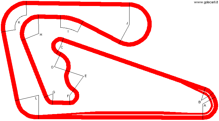
| Description | I don’t know which value is the right one. On the same original drawing (made by Ing. Jorge A.Valverde) total length reported is 3000 m, but the sum of all partial distance is 2938 m (see below). | ||||
| Years | |||||
| Direction |  Anticlockwise Anticlockwise | ||||
 Proposal Proposal |
NO | ||||
| No longer operational | |||||
| Car Circuit | YES | ||||
| Motorbike circuit | |||||
| Type | Permanent | ||||
| Inauguration | 1974 | ||||
| Closing | |||||
| Last update of this page | December 7th 2004 | ||||
| Info last update | |||||
| Designer | |||||
| Distinctive points | |||||
| length | 2938 m | 9639 ft | 1.826 mi | (3) | |
| length | 3000 m | 9843 ft | 1.864 mi | (3) | |
| Width | 12 m | 39 ft | (3) | ||
Long course
| DETAILS | ||||||||||||||||||||||||||||||||||||||||||||||||||||||||||||||||||||||||
* These values could be wrong |
| PHOTOS |
| Photos by Ivan Sala - November 26th 2007 |
| Click on thumbnail to open original large photo |
| 1 | 2 | ||
 |  | ||
| Aerial photo Dirt section inside esses is Supermoto section. Red circle is the bull arena. | Zoomed detail of the previous photo |
| Updates | |||||||
| Date | Track layout | Years | Description by | Map by | Thanks to | Note | |
| November 30th 2007 | Guido de Carli | Ivan Sala | New | Photos (on this site) | |||
| August 12th 2005 | Autódromo La Guácima | Guido de Carli | Update | Description | |||
| December 7th 2004 | Autódromo La Guácima | Guido de Carli | New | Description | |||
| December 6th 2004 | Autódromo La Guácima | Guido de Carli | Guido de Carli | Update | Description with map | ||
| July 31st 2002 | Guido de Carli | Guido de Carli | New | Description with map | |||
| Not all eventual updates issued in last years are already visible in this list | |||||||