| USA - UNITED STATES | |||||||||
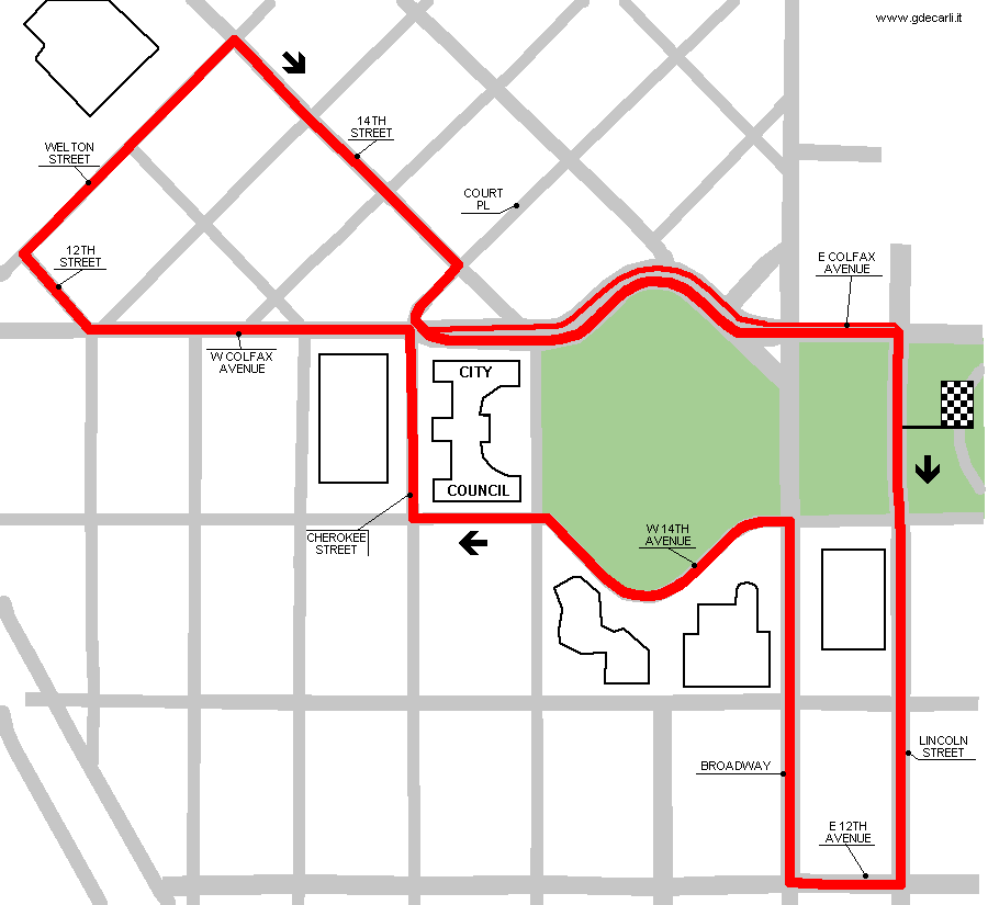
| DENVER, CIVIC CENTER PARK | |||||||||
| Description | Street circuit, used by Cart in 1990 and 1991. | ||||||||
| Location | Civic Center Park, Denver CO - Colorado - Western States | ||||||||
| Location | Around Civic Center Park, Denver | ||||||||
| Latitude - Longitude | + 39°44'20" -104°59'10" 39.738889 -104.986111 | ||||||||
| UTM Coordinates | X = 501190.064 - Y = 4398777.199 - Zone 13S | ||||||||
| Aerial photo / Map (*) |  OpenStreetMap - Google Maps - Bing Maps - Flash Earth - Wikimapia - Microsoft Research Maps - MapQuest OpenStreetMap - Google Maps - Bing Maps - Flash Earth - Wikimapia - Microsoft Research Maps - MapQuest | ||||||||
| Altitude AMSL | 1600 m - 5249 ft | ||||||||
| Inauguration | August 26th 1990 | ||||||||
| Closing | August 25th 1991 | ||||||||
| Designer | |||||||||
| Sources and links (Translation) (**) |
| ||||||||
| Denver, Civic Center Park | |||||
| Description | |||||
| Years | 1990÷1991 | ||||
| Direction |  Anticlockwise Anticlockwise | ||||
 Proposal Proposal |
NO | ||||
| No longer operational | YES | ||||
| Car Circuit | YES | ||||
| Motorbike circuit | |||||
| Type | Street course | ||||
| Inauguration | August 26th 1990 | ||||
| Closing | August 25th 1991 | ||||
| Last update of this page | May 29th 2007 | ||||
| Info last update | |||||
| Designer | |||||
| Distinctive points | |||||
| length | 3057 m | 10030 ft | 1.9 mi | ||
| length | 3170 m | 10400 ft | 1.97 mi | (1) | |
Denver, Civic Center Park
| Updates | |||||||
| Date | Track layout | Years | Description by | Map by | Thanks to | Note | |
| May 29th 2007 | Lorenzo Tommasi | Lorenzo Tommasi | Update | Map | |||
| July 23rd 2006 | 1990÷1991 | Guido de Carli | Update | Description | |||
| April 22nd 2006 | 1990÷1991 | Guido de Carli | Update | Description | |||
| June 7th 2003 | Guido de Carli | Update | Description | ||||
| November 10th 2002 | Guido de Carli | Update | Map | ||||
| Not all eventual updates issued in last years are already visible in this list | |||||||


