| ZIM - ZIMBABWE | |||||||||||||
| CRANBORNE ROAD RACE CIRCUIT | |||||||||||||
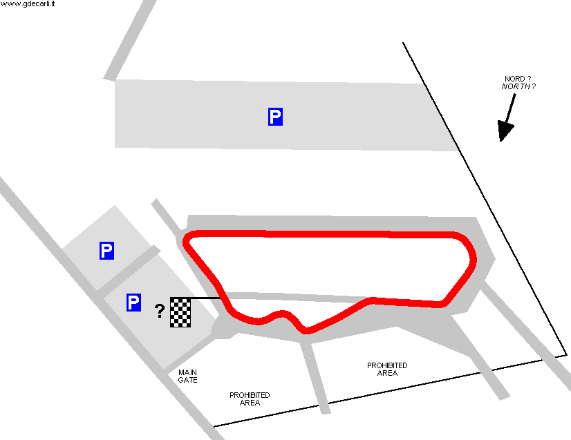
| Description | Airfield circuit, even if original map call it "Road Circuit". I have no more info... Until 1952 Cranborne was a military airfield, then the base was closed and the area was built over | ||||||||||||
| Location | Cranborne (Harare / Salisbury) - Harare | ||||||||||||
| Location | Approx. 5 km - 3 mi south east of Salisbury town center (renamed Harare on April 18th 1982). Before April 18th 1980, Zimbabwe was named Southern Rhodesia. | ||||||||||||
| Latitude - Longitude (approx) | - 17°51'30" + 31°05'00" (approx) -17.858333 31.083333 (approx) | ||||||||||||
| UTM Coordinates (approx) | X = 296904.24 - Y = 8024445.816 - Zone 36K (approx) | ||||||||||||
| Aerial photo / Map (*) |  OpenStreetMap - Google Maps - Bing Maps - Flash Earth - Wikimapia OpenStreetMap - Google Maps - Bing Maps - Flash Earth - Wikimapia | ||||||||||||
| Altitude AMSL (approx) | 1500 m - 4921 ft (approx) | ||||||||||||
| Inauguration | |||||||||||||
| Closing | |||||||||||||
| Designer | |||||||||||||
| Sources and links (Translation) (**) |
| ||||||||||||
| Cranborne Road Race Circuit | |||||
| Description | |||||
| Years | |||||
| Direction | |||||
 Proposal Proposal |
NO | ||||
| No longer operational | YES | ||||
| Car Circuit | YES | ||||
| Motorbike circuit | |||||
| Type | Airfield course | ||||
| Inauguration | |||||
| Closing | |||||
| Last update of this page | June 29th 2006 | ||||
| Info last update | |||||
| Designer | |||||
| Distinctive points | |||||
Cranborne Road Race Circuit
| Updates | |||||||
| Date | Track layout | Years | Description by | Map by | Thanks to | Note | |
| March 29th 2006 | Guido de Carli | Guido de Carli | Marius Matthee | New | Description with map | ||
| Not all eventual updates issued in last years are already visible in this list | |||||||



