| USA - UNITED STATES | |||||
| ARDMORE AIRPARK | |||||
| Description | |||||
| Location | Springer OK - Oklahoma - Southern States | ||||
| Location | Ardmore Municipal Airport | ||||
| Latitude - Longitude | + 34°18'04" - 97°00'49" 34.301111 -97.013611 | ||||
| UTM Coordinates | X = 682802.4 - Y = 3797329.562 - Zone 14S | ||||
| Aerial photo / Map (*) |  OpenStreetMap - Google Maps - Bing Maps - Flash Earth - Wikimapia - Microsoft Research Maps - MapQuest OpenStreetMap - Google Maps - Bing Maps - Flash Earth - Wikimapia - Microsoft Research Maps - MapQuest | ||||
| Altitude AMSL | 223 m - 732 ft | ||||
| Inauguration | |||||
| Closing | |||||
| Designer | |||||
| Sources and links (Translation) (**) |
| ||||
| Ardmore Airpark | |||||
| Description | |||||
| Years | |||||
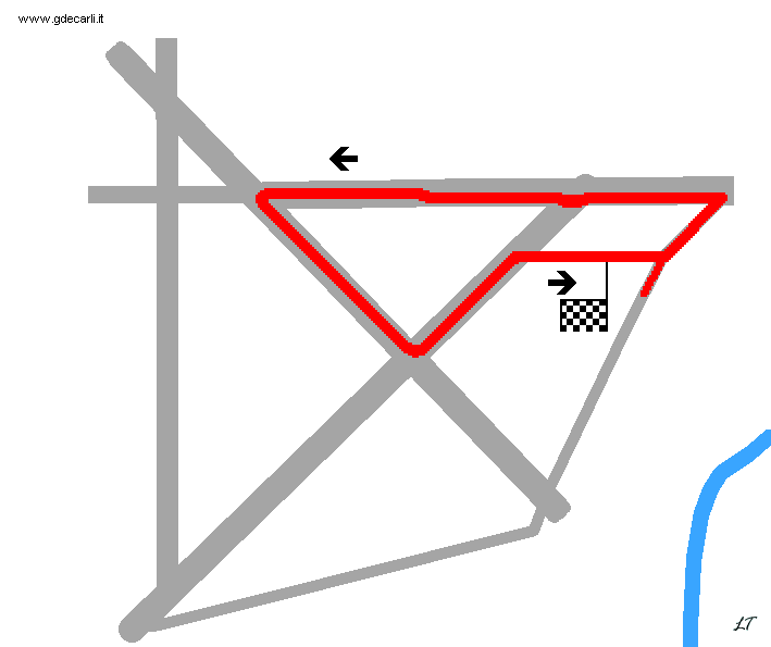
| Direction |  Anticlockwise Anticlockwise | ||||
 Proposal Proposal |
NO | ||||
| No longer operational | |||||
| Car Circuit | |||||
| Motorbike circuit | |||||
| Type | Airfield course | ||||
| Inauguration | |||||
| Closing | |||||
| Last update of this page | February 13th 2007 | ||||
| Info last update | |||||
| Designer | |||||
| Distinctive points | |||||
| length | 4184 m | 13728 ft | 2.6 mi | (1) | |
Ardmore Airpark
| Updates | |||||||
| Date | Track layout | Years | Description by | Map by | Thanks to | Note | |
| February 13th 2007 | Guido de Carli | ||||||
| Not all eventual updates issued in last years are already visible in this list | |||||||


