| ARG - ARGENTINA | |
| MAGGIOLO | |
| SORRY, SOME DATA ARE NOT TRANSLATED YET | |
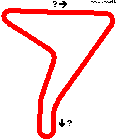
| Description | Circuit no longer operational, its area now is used for soybean cultivation. I have no info |
| Location | Maggiolo S - Santa Fé - Centro |
| Location | |
| Latitude - Longitude | - 33°42'38" - 62°14'20" -33.710556 -62.238889 |
| UTM Coordinates | X = 570525.25 - Y = 6269676.26 - Zone 20H |
| Aerial photo / Map (*) |  OpenStreetMap - OpenStreetMap -  Google Maps - Google Maps -  Bing Maps - Bing Maps -  Flash Earth - Flash Earth -  Wikimapia Wikimapia |
| Altitude AMSL | 115 m - 377 ft |
| Inauguration | August 30th 1969 |
| Closing | 1974 |
| Designer | |
| Sources and links (Translation) (**) | |
| Maggiolo | |||||
| Description | |||||
| Years | 1969÷1974 | ||||
| Direction | |||||
 Proposal Proposal |
NO | ||||
| No longer operational | YES | ||||
| Car Circuit | YES | ||||
| Motorbike circuit | |||||
| Type | Permanent | ||||
| Inauguration | 1969 | ||||
| Closing | 1974 | ||||
| Last update of this page | October 12th 2011 | ||||
| Info last update | |||||
| Designer | |||||
| Distinctive points | |||||
| length | 3133 m | 10279 ft | 1.947 mi | (4) | |
| length | 3313 m | 10869 ft | 2.059 mi | (2) | |
Maggiolo

| Updates | |||||||
| Date | Track layout | Years | Description by | Map by | Thanks to | Note | |
| October 12th 2011 | 1969÷1974 | Guido de Carli | Luis Alberto González | Update | Description | ||
| July 29th 2005 | 1969÷1974 | Guido de Carli | Pablo Vignone | Update | Description | ||
| July 28th 2005 | 1969÷1974 | Guido de Carli | Guido de Carli | New | Description with map | ||
| Not all eventual updates issued in last years are already visible in this list | |||||||
