| ARG - ARGENTINA | |||||||||||||||||||||
| RESISTENCIA, SANTIAGO YACO GUARNIERI | |||||||||||||||||||||
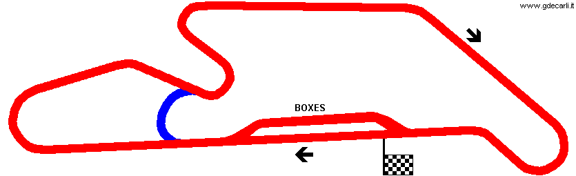
| Description | Circuit first used on June 24th 1979. According to all source the track is 2695 m long, but AGE: in his mail he told me track length is 3214 m. Two data are referred to two differents layouts shown in my map or one info (which one?) is wrong? Moreover, map sent me by AGE (the one I used to draw mine) has a layout slighlty different from other maps on the web: one of them is not very accurate or last corner before finish line was changed? | ||||||||||||||||||||
| Location | Resistencia H - Chaco - Norte Grande Argentino | ||||||||||||||||||||
| Location | |||||||||||||||||||||
| Latitude - Longitude | - 27°23'16" - 59°00'18" -27.387778 -59.005 | ||||||||||||||||||||
| UTM Coordinates | X = 301736.928 - Y = 6969017.393 - Zone 21J | ||||||||||||||||||||
| Aerial photo / Map (*) |  OpenStreetMap - Google Maps - Bing Maps - Flash Earth - Wikimapia OpenStreetMap - Google Maps - Bing Maps - Flash Earth - Wikimapia | ||||||||||||||||||||
| Altitude AMSL | 50 m - 164 ft | ||||||||||||||||||||
| Inauguration | June 24th 1979 | ||||||||||||||||||||
| Closing | |||||||||||||||||||||
| Designer | |||||||||||||||||||||
| Sources and links (Translation) (**) |
| ||||||||||||||||||||
| Autódromo Santiago Yaco Guarnieri | |||||
| Description | |||||
| Years | |||||
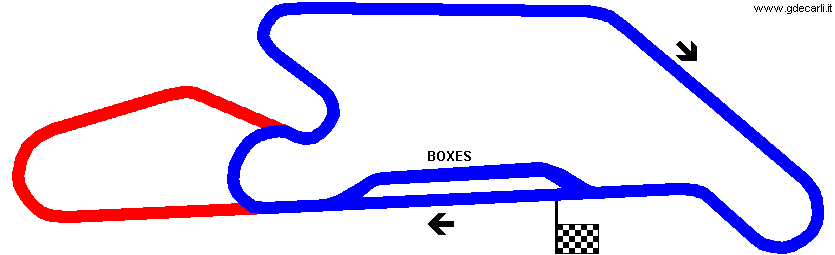
| Direction |  Clockwise Clockwise | ||||
 Proposal Proposal |
NO | ||||
| No longer operational | |||||
| Car Circuit | YES | ||||
| Motorbike circuit | |||||
| Type | Permanent | ||||
| Inauguration | June 24th 1979 | ||||
| Closing | |||||
| Last update of this page | July 8th 2007 | ||||
| Info last update | |||||
| Designer | |||||
| Distinctive points | |||||
| length | 2695 m | 8842 ft | 1.675 mi | (2) | |
| length | 2695 m | 8842 ft | 1.675 mi | (4) | |
| length | 3214 m | 10545 ft | 1.997 mi | (1) | |
| length | 3214 m | 10545 ft | 1.997 mi | (5) | |
Resistencia, Santiago Yaco Guarnieri
| Updates | |||||||
| Date | Track layout | Years | Description by | Map by | Thanks to | Note | |
| November 5th 2007 | Guido de Carli | Update | Description without map | ||||
| January 15th 2005 | Autódromo Santiago Yaco Guarnieri | Guido de Carli | New | Description with map | |||
| September 15th 2004 | Autódromo Santiago Yaco Guarnieri | Guido de Carli | New | Description | |||
| Not all eventual updates issued in last years are already visible in this list | |||||||


